Global Fishing Watch is a technology initiative that aims to highlight global fishing activity. It is a PYBOSSA-powered interactive platform that uses satellite data to inform the public about overfishing and make global fishing activity more transparent.
The Team
GFW is a partnership between SkyTruth (the same team of developers behind FrackFinders), Oceana and Google Ocean & Earth Outreach. With team members in Argentina, Sweden, West Virginia and California, GFW represents a global effort against overfishing.
The Problem
Global overfishing is destroying ocean ecosystems. Nearly one third of marine fish stocks worldwide have been overfished and over 90% of the world’s fisheries are fully exploited or over-fished according to a 2014 UN report. Global fishing fleets operate far out at sea and their activities are extremely difficult to monitor.

Operating in remote locations, vessels are difficult to track. Photo by Marius Fiskum.
The Solution
Almost all large ocean-going vessels are required to carry an Automatic Identification System (AIS), which periodically broadcasts a vessel’s location and identity. The system was designed for collision avoidance, however, satellites can use these signals to track the movements of large fishing vessels. “If you can see it, you can change it” states David Kroodsma, GFW’s Research Program Manager.

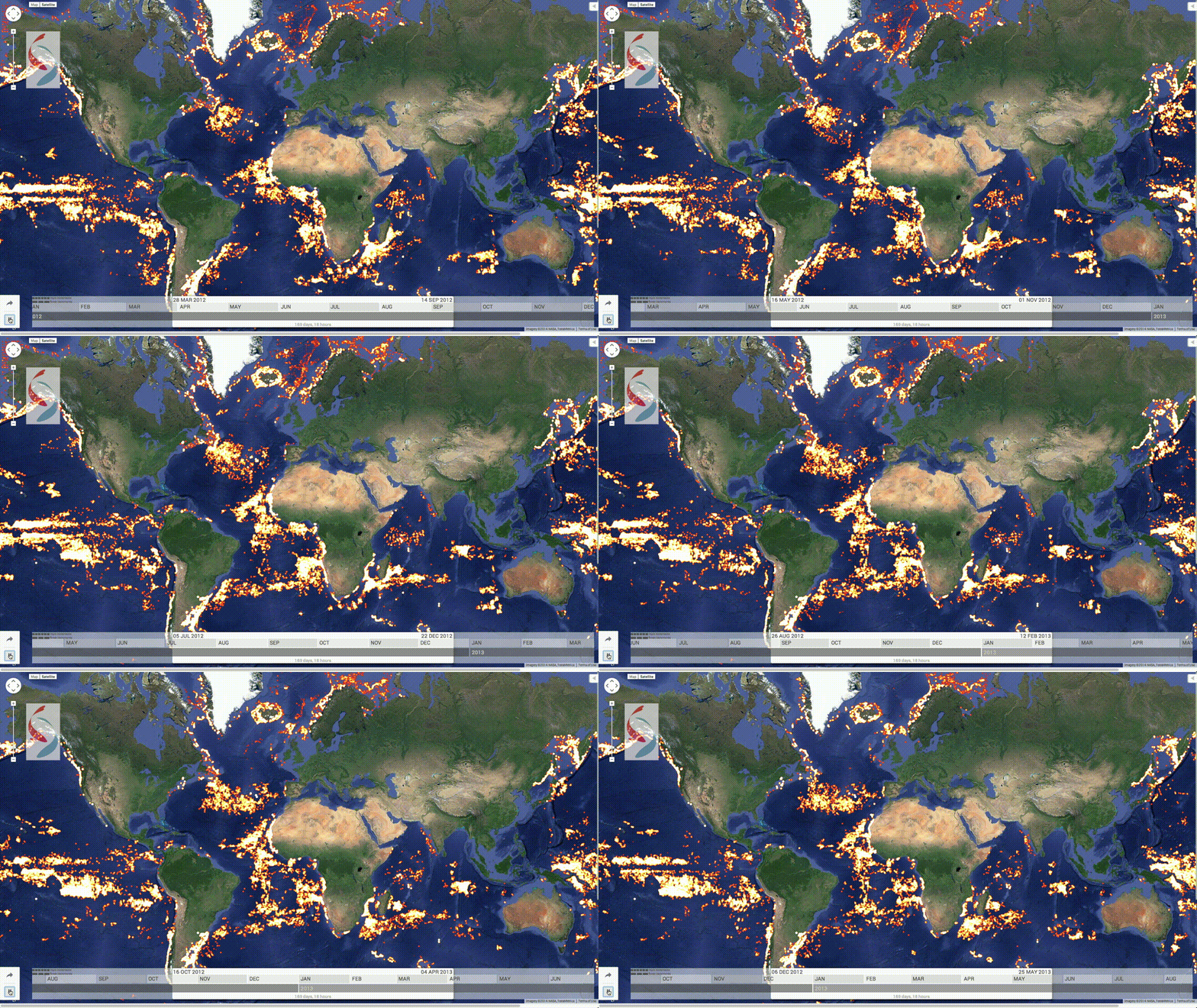
A global view of fishing vessels in 2012. Image by SkyTruth.
GFW provides an interactive web tool that will allow anyone with an internet connection to visualise the global fishing fleet in space and time, and reveal the intensity of the fishing effort around the world. This will enable: citizens to see whether their fisheries are being effectively managed; seafood suppliers to keep tabs on the boats they buy fish from; media and the public to act as watchdogs to improve the sustainable management of global fisheries; fisherman to show that they are obeying the law; and researchers to access a multi-year record of all trackable fishing activity.
The Challenges
Kroodsma notes that the project has three major challenges to overcome: “Firstly, we face the challenges of any Big Data exercise: wrangling and cleaning the data to extract useful answers (we have 20 million new data points each day!). Secondly, we need to identify vessels as fishing boats. Thirdly, we need to determine from the movement of a vessel whether or not it is fishing. This is a pattern recognition problem and so input from citizens is really useful.”

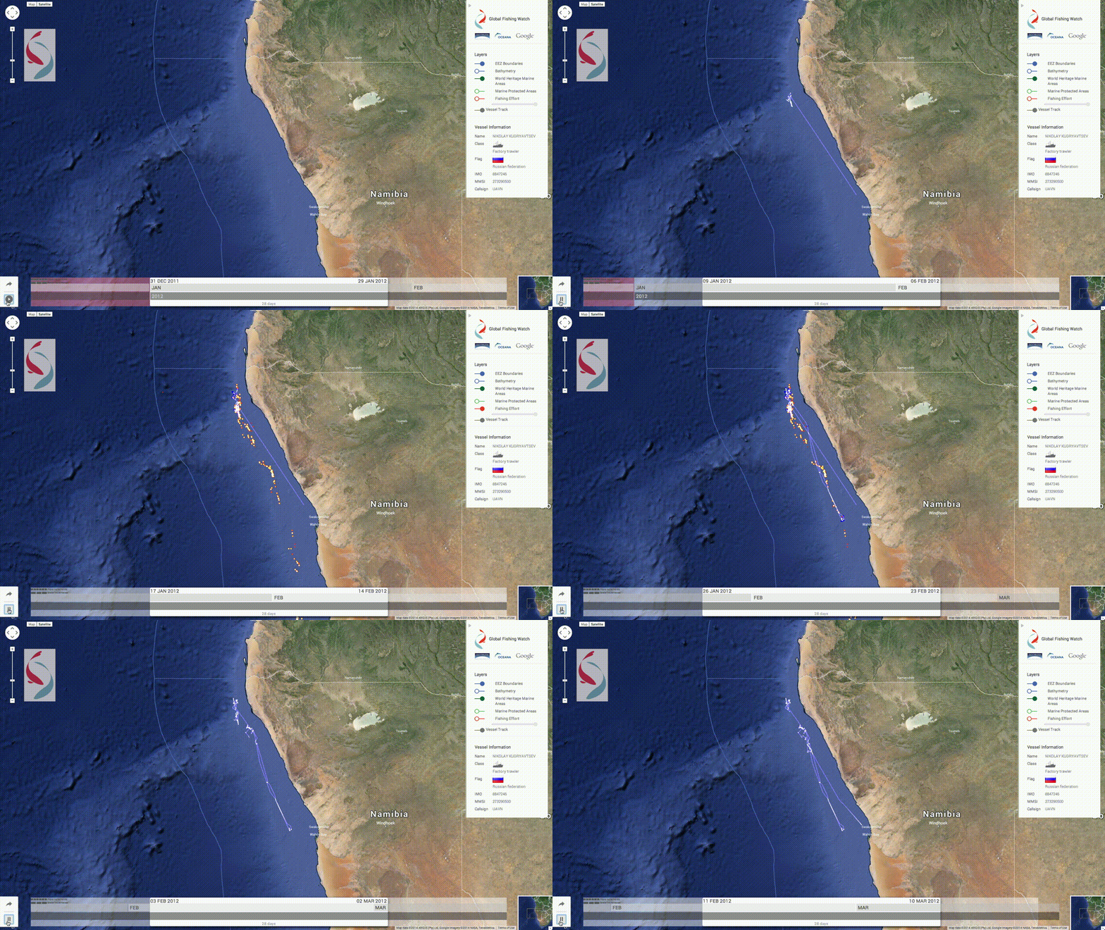
Is this Russion trawler off the cost of Namibia displaying 'fishing-like behaviour'? Image by SkyTruth.
Why PYBOSSA?
Developers at project partner SkyTruth had experience of using PYBOSSA to build FrackFinder, so they were familiar and comfortable with the technology. “Most importantly however is the fact PYBOSSA is open source” notes Kroodsma. “We strongly believe that more transparency of data leads to better outcomes; so philosophically PYBOSSA was a good fit.”
The Results (so far)
On 1 January 2015, the Phoenix Islands Protected Area (PIPA) – a swathe of unspoilt ocean located in the central Pacific between Hawaii and Australia that is the world’s largest UNESCO World Heritage Site – was officially closed to industrial fishing. GFW has been used to monitor the park to ensure fishing vessels are staying out. The video below shows how fishing vessels cleared the marine area.
Will it make a difference?
“Like it or not, humans have become the managers of the World’s physical systems” states Kroodsma. “To manage effectively, we require good data. GFW provides a tool that we can use to better manage the world’s oceans. Ensuring the long-term sustainability of our oceans is a critical global priority.”
Interested? Want to help? Check out Global Fishing Watch’s brand new interactive website.